
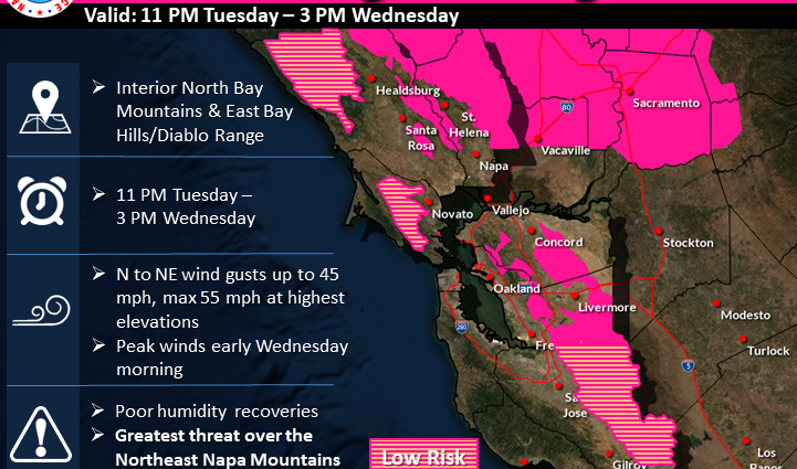
A trough (Low-Pressure system) is impacting NorCal today into midweek. As it tracks eastward, we are forecasting enhanced N to NE winds that will produce dry, gusty offshore flow. These winds are forecast to peak from Tuesday evening into Wednesday afternoon. These dry, gusty offshore winds will return again to a lesser extent Wednesday night into early Thursday, but not as strong as the first round. These winds will lead to poor overnight humidity recoveries and cause daytime humidities to plummet into the upper single digits to mid-teens in the driest locations midday. These atmospheric conditions, in conjunction with record dry fuels in these impacted areas, will increase the likelihood of both new wildfire starts and the rapid rate of spread of any fires that do start. In addition to fire weather concerns, the smoke from NorCal wildfires is forecast to get wrapped into the trough and spread smoke southward into the Bay Area Tuesday evening into Wednesday. Near surface smoke will increase in concentration starting in the North Bay Tuesday night and then spreading southward into Wednesday. Please take precautions and keep windows closed if you can smell smoke in your area.
/www.wrh.noaa.gov/
NOAA National Weather Service